We spent a day in Sheridan, Wyoming – Cousin John’s daughter, Kerry Poehlman, has called this home for many years. We had hoped to connect with her, but it was not to be. Regardless, we enjoyed seeing so many places we had heard her speak of that somehow we felt connected.

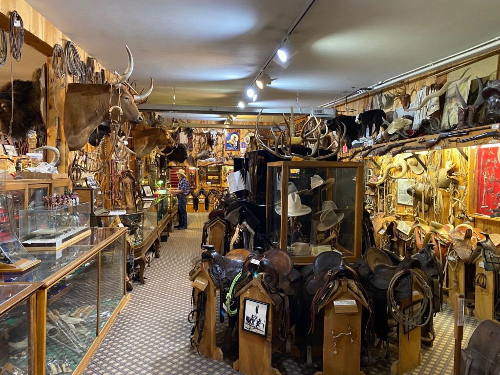
owned by a good friend of Kerry’s, Monty Buckmaster

Then off we went to a marvelous week in South Dakota. The landscape changed dramatically as we left the Rocky Mountains. Plains and prairies greeted us as we traveled eastern Wyoming and then through Spearfish and Sturgis, South Dakota. We missed the Sturgis Bike Ride by one weekend, but we didn’t miss a significant number of riders as they made their way to South Dakota to enjoy the rides and scenery before Sturgis!
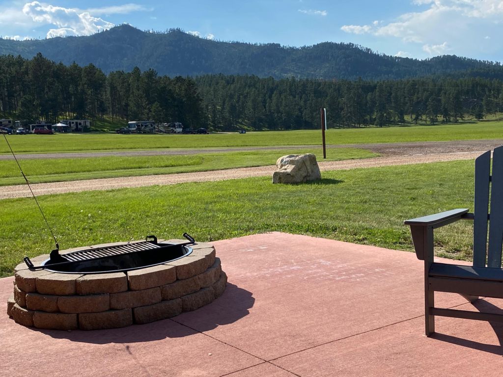
At Rapid City, we turned south to Hill City – and the Black Hills of South Dakota. Our destination for 4 nights was Rafter J Bar Ranch and it was a stunning property. We both agreed it was, undoubtedly, the best campground we can recall.

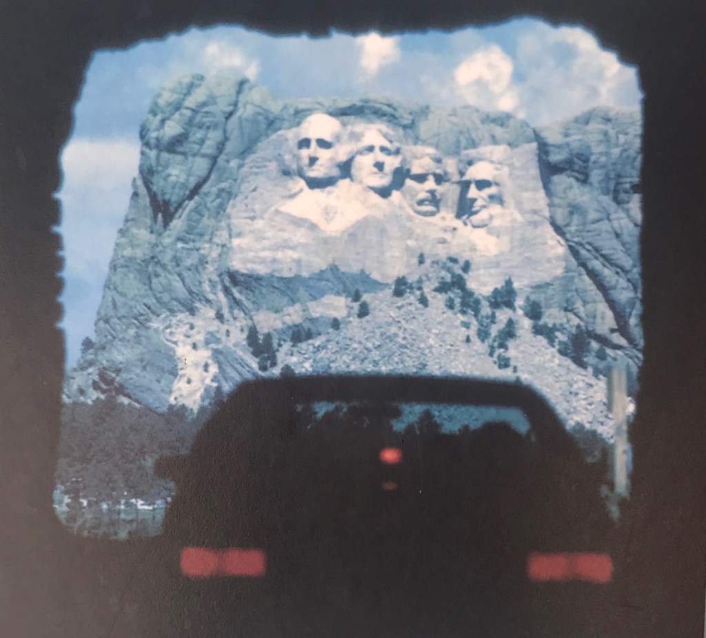
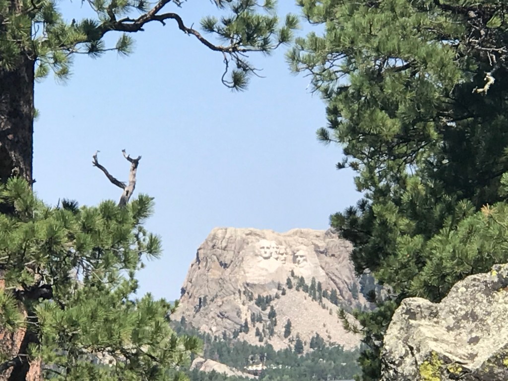
Never one to let the moss grow under our feet, we were at the entrance to Mt. Rushmore by 6:30a the next morning. Words can’t describe the majesty of the sun rising on the faces carved into these mountains. We were basically alone at the Monument for the first hour we were there – as we walked the Presidential Trail, viewed the Monument from variety of approaches and learned about each of the four men enshrined on the side of an astounding mountain top.
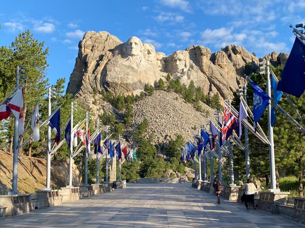
When the coffee shop opened at 8:00a, we grabbed a second cup and rented audio tour devices. We found a comfortable spot gazing at the Monument and away from the growing crowds and had an enjoyable hour learning the history and details of this amazing place, its creators and detractors and the 14 years of labor it took to bring this incredible work of art to reality.
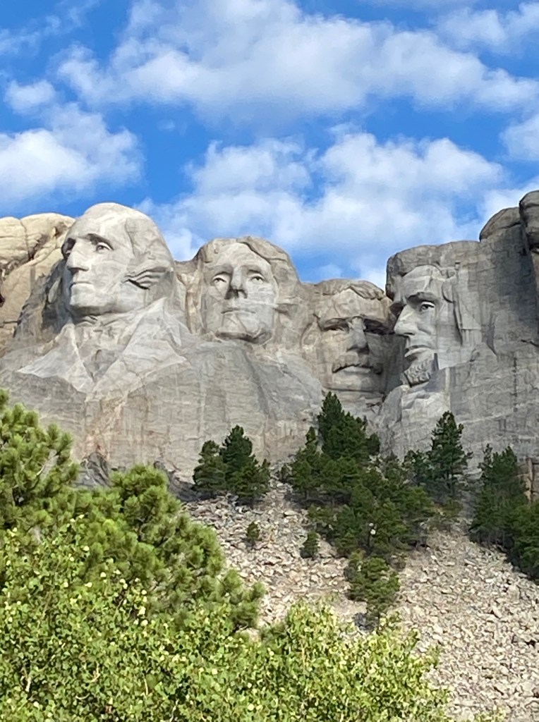
We learned that 90% of the “carving” of the mountain was done by dynamite. Strategic drilling and precise charges allowed the workers (hundreds over the 14 years) to follow the vision of Gutzon Borglum. Borglum was a world-renowned sculptor, having already been involved with other public works of art across the USA, including Stone Mountain in Georgia, the statue of Union General Philip Sheridan in Washington DC, and a bust of Abraham Lincoln that was in the White House for many years (beginning with Theodore Roosevelt).
There were many trials and changes along that 14 year journey. Originally, it was to be only Washington & Jefferson – and Jefferson was to be to be left of Washington. If you look closely, you can see where the side to the left of Washington has had much “work done” on the mountain. Even after a major part of Jefferson’s face was evident, the entire area was blasted away as the granite was not “right” for sculpting. Where Lincoln’s head now resides on the right side of the sculpture was to be a tablet, written by Calvin Coolidge, on the contribution of Washington and Jefferson. Coolidge wrote the 500 word essay and sent it to Borglum, who made edits that Coolidge did not approve. The tablet never happened and Abraham Lincoln appeared in its place!
In some areas of the mountain that was to become Mt. Rushmore, more than 100′ of mountainside had to be removed in order to get to “scuplt-able granite”. While 90% was accomplished with blasting, the remaining 10% was done by hand with a jackhammer. The entire creation is truly mind-boggling!


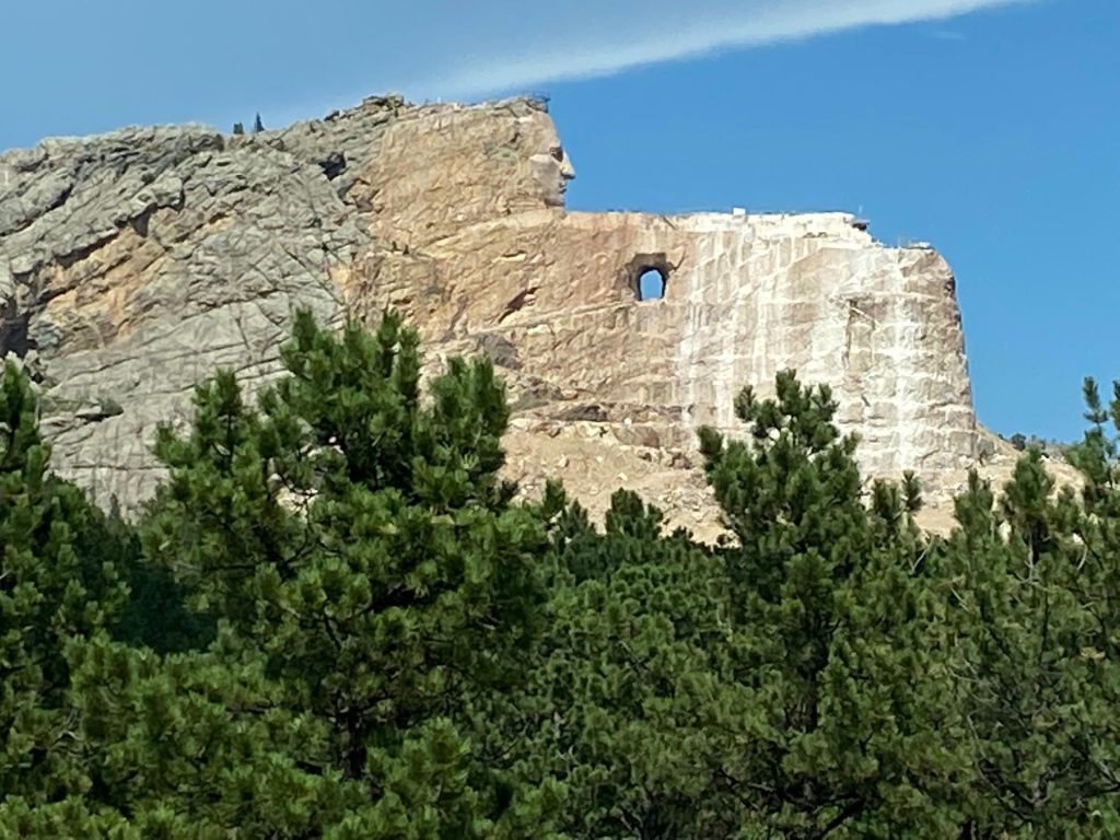
From there, we headed to Crazy Horse – and what a difference! In 1933, coinciding with the creation of Mt. Rushmore, Chief Henry Standing Bear of the Brule Lakota Tribe envisioned a memorial to Crazy Horse and Native America heritage. He felt strongly that it needed to be in the Black Hills, because of the spiritual significance of these hills to his heritage. He set about identifying the “right person” to bring this creation to reality. It would be 14 years before Korczak Ziolkowsk at age 40 would finally arrive at the mountain, some 10 miles from where Mt. Rushmore had been “completed” in 1941. Korczak would dedicate the remainder of his life to the Crazy Horse dream, along with his wife Ruth, who had come to Crazy Horse to document the efforts. They fell in love and had 10 children, all of whom worked “on the mountain.”
Although Korczak began in 1948, 75 years have now passed and all that is evident is the face and the beginning of an arm! It is an artistic rendition that combines what historians believe Crazy Horse might have looked like and a compilation of features evident in the many tribes of the Sioux, Cheyenne and Crow. Crazy Horse had always refused to have photograph taken – he felt it would steal his soul. The face was completed in 1998 and is 87.5′ tall (the Presidents at Mt. Rushmore are 60′!). The dimensions for the entire sculpture are planned to be 641′ long and 564 ‘ high.
hand pointing
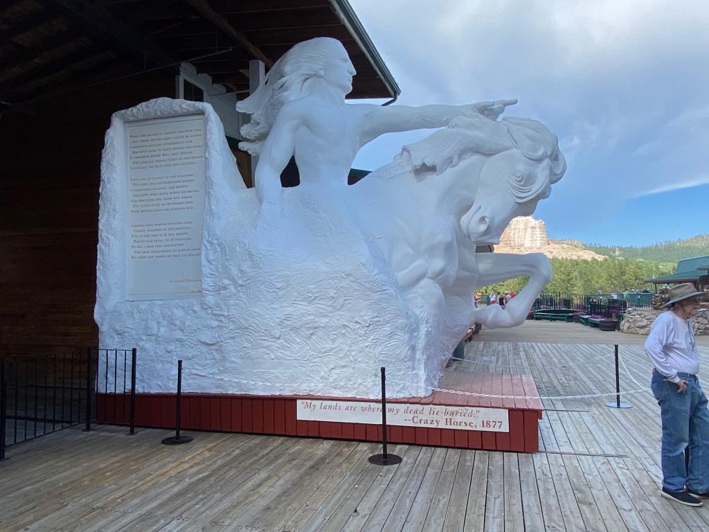
Twice, Korczak was offered $10M from the US Government to assist in costs associated with the memorial to our Native American heritage. And twice, he turned it down! Whatever his reasoning, it is so sad that what could be a major visible recognition of the “other side of the story” continues to languish. Korczak died unexpectedly in 1972 at age 74 and Ruth took the leadership role. Today, the Memorial Foundation is a non-profit undertaking and does not accept federal or state funds. Our perception was, unfortunately, that the money raised is going more to make a tourist attraction with little focus on completing the vision.
The next day, we shared a unique experience – riding a steam-engine train from Hill City to Keystone through more gorgeous terrain and learning the history of the train’s impact on everything in this region. The 10 mile journey took about one hour each way and it was a delightful and relaxing way to spend an afternoon. We learned about the leadership hierarchy on a train – the “big boss” is the conductor! Then comes the engineer and fireman – the engineer is responsible for speed and steering of the train and the fireman is responsible for building & monitoring the steam levels in the boiler, which provides the propulsion for the train.

still line the trainbed
Our last day in the Black Hills was one of those rare, unexpected treats. That morning, Bill picked up one of many brochures – and there was a road trip we HAD to take. Off we went up Iron Mountain! A narrow, two-lane road envisioned by Peter Norbeck as a way for people to see the real beauty of these marvelous Black Hills. There are breath-taking views – and three one-lane tunnels to navigate. The tunnels are strategically crafted so that, if you are passing through in the “correct” direction, Mt. Rushmore is in full majestic view as you traverse and exit the tunnel.
There are many definitions of how the Black Hills got their name. The dark green needles of the Ponderosa Pines that are native and prevalent across this mountains give the Black Hills a dark, warm and comfortable aura. The translation from the Native American tribes that treasured this sacred ground called it “Hills of the Cedars.” There is no evidence today of cedar trees as we know them being native to this land, so somewhere in translation and understanding is the real mystery of this beautiful land.
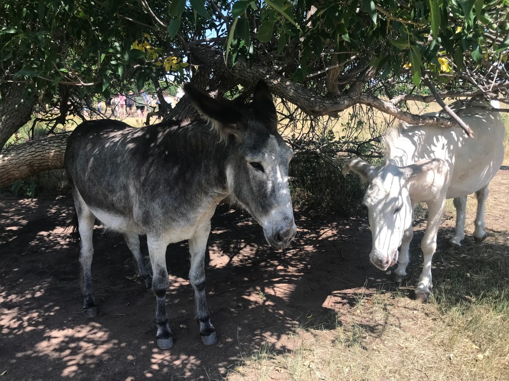
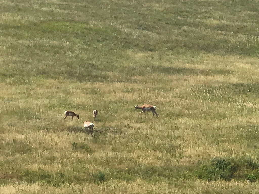
From Iron Mountain, we enjoyed the Custer State Park and it’s wildlife loop. Once extinct, bison were reintroduced to the region when it became protected and over a number of years, the herd grew to nearly 2,500 head. The grasslands of the Park can realistically support around 1,200-1,500 head. So, in the fall of each year, the State Park holds a round-up and the herd is thinned by selling the bison at auction. We didn’t see any bison, but we saw antelope, burros and long horn sheep. Many years ago, the burros were brought into the area to transport visitors up Black Elk Mountain. When that ceased, the burros were released into the State Park and their descendants are part of the population – the only ones you dare get close to!
And then, off we went to drive “The Needles” – another amazing road conceived by Peter Norbeck. This road, as unimaginable as it seemed, was even narrower and more twisted that Iron Mountain. This time, the view was always heaven-bound as the pinnacles extend to the sky. Eroded granite pillars, towers and spires, the Needles were the originally proposed site for Mt. Rushmore, but were rejected by Sculptor Gutzon Borglum because of the poor quality of the granite and because they were too thin to support the sculptures.

Contessa & the Toad headed east to the Badlands. Along the way, we HAD to make the compulsory stop at Wall Drug, which really is the town of Wall, South Dakota! Since its beginning in 1931, Wall Drug has provided refreshing ice water to all travelers – and the draw in the early days was enough to build the reputation as a “stop on the road that one HAD to make”. Today, it is a 76,000 sq ft mecca of every souvenir one could ever imagine – cafes brimming with every food group one should probably never consume – and the BEST homemade ice cream!
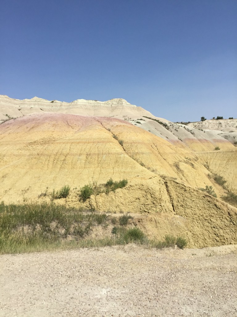
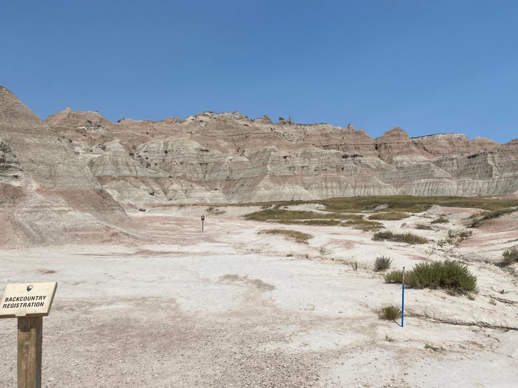
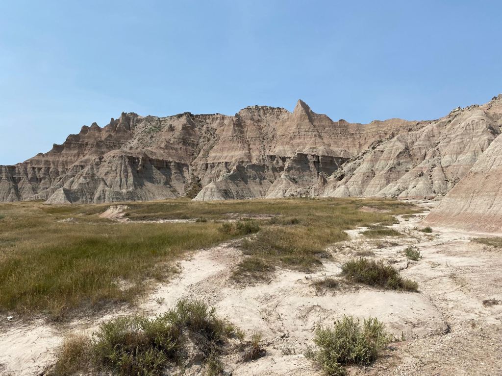
After that, we HAD to explore the Badlands, even if it was 1050! The “wall” extends west from Kadota and terminates south of Wall – hence the name of the town now known for the “drugstore”. Geology is an amazing science – and the understanding of how these protrusions differ so greatly from both the Black Hills and the Rocky Mountains filled us with wonder.
The Badlands are NOT the result of earthquakes the way we have seen from the Grand Tetons to Glacier and points north, but they are deep canyons, towering spires and flat-topped tables created by erosion and deposition. More than 75 million years ago, the Earth’s climate was warmer than it is now and a shallow sea covered the region we know call the Great Plains. From the Gulf of Mexico to Canada and from western Iowa to western Wyoming, the sea teemed with life. The continental plate movements that created the Rocky Mountains and Grand Tetons raised the floor under the sea forcing the waters to retreat and drain away. The region transitioned to a humid and warm subtropical forest. The forest gave way to savannahs and then to grasslands. Then, as rivers began to cut their way through these savannahs and grasslands, the sedimentary soil began washing this fossilized soil toward the Gulf of Mexico.
The Sharps Formations of the Badlands were primarily formed by deposits 28-30 million years ago. As we drove through this unique and ethereal area, we were reminded of our journey a few years ago in the Painted Desert in northwestern Arizona. The layers reflected in different colors indicate the various impacts on the land. The bands of the Brule Formation period (30-34 million years ago) occurred as the land began to dry; the red layers are fossil soils. The gray of the Chadron Formation occurred 34-37 million years ago as the river flood plain replaced the sea. At the base are the Yellow Mounds created as the black ocean mud became exposed to the air.
Our last day in this beautiful country known as South Dakota was one of our “just a stop along the road at the right mileage”. Mitchell SD, like so many of these stops, gave us so much that we never anticipated.
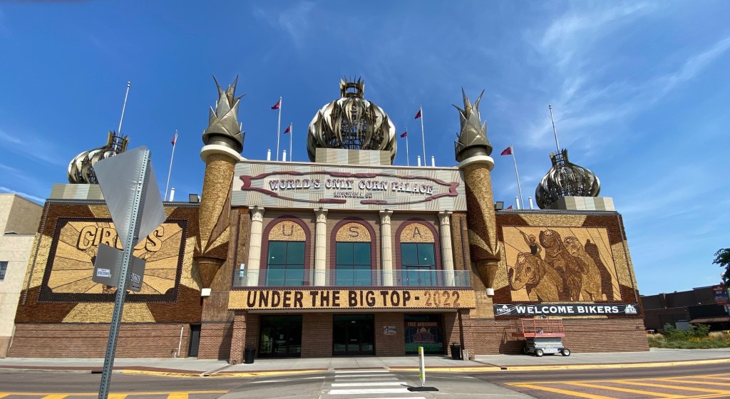
In the last part of 19th century, a number of cities built “crop palaces” to promote their area and build a destination for travelers to marvel and enjoy. From 1887 to 1930, at least thirty-four corn palaces were built across the Midwest; only the Mitchell Corn Palace remains.
It functions today as a multi-purpose arena/facility, home to the Dakota Wesleyan University Tigers and the Mitchell High School Basketball teams, the KERNELS! It also houses City Hall and many of the administrative officers for the region.
Every year, the facade of the building and all the murals inside this amazing structure are stripped, and new designs created and transferred onto roofing paper then mounted into place. An small army of artisans utilize six variants of corn (different colors) from 100 acres grown specifically for Corn Palace which are trimmed to size and placed on the pattern. Our guide said to think of it as “corn by numbers”! On average, they will use 287,000 bushels of corn!

The next morning before we headed to South Sioux City, Nebraska, we went to Shorty’s Meat Locker. Meat lockers abound throughout this part of the country, processing, storing and selling meat from local livestock. We simply had to have some locally made bratwurst for our family gathering next week in Kentucky. These are Jann’s Keen cousins (Mom’s side) – and their Uncle Shorty Keen was very precious to all of them.
And then, we were off – leaving South Dakota behind for this trip. God willing – we’ll be back!
